Bikepacking the Sky Islands Odyssey East Loop
Bikepacking: Probably the Best Ever Way to Spend the Weekend
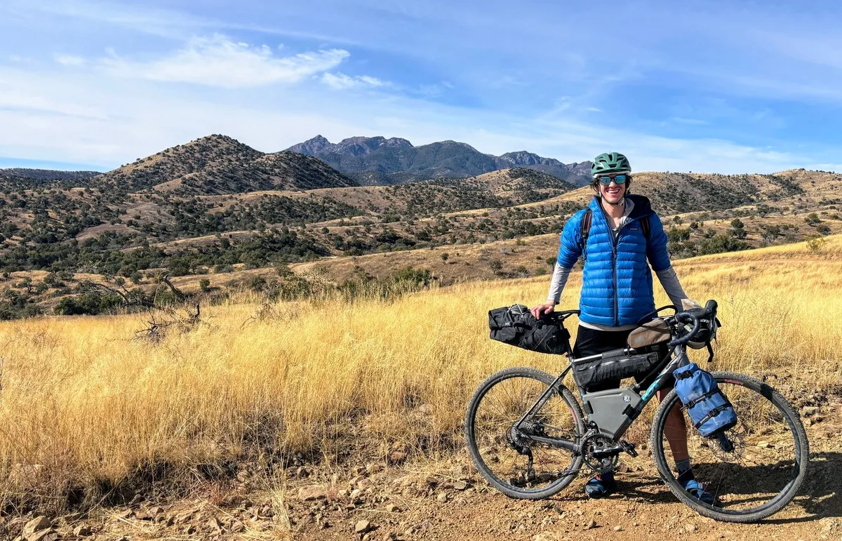
What a blessed life I am living. Last month I was fortunate enough to complete a 120 mile bikepacking loop in Southern Arizona with my friend Hannah, one of the awesome humans I trained and worked with as a Backroads leader. The Sky Islands Odyssey was a beautiful circumnavigation of the Santa Rita Mountains in Southern Arizona just a few miles above the Mexico border.
Over four days and three nights we experienced a beautiful chasm of life and biodiversity featuring grasslands, forests, and deserts, an abundance of wildlife, bright starry skies, and a glimmer into historic remnants of mining camps and a Spanish expedition.

Along the way we had a ton of fun and plenty of interactions with kind strangers that continue to remind me that the world is fundamentally good and full of caring people.
A huge thank you to Sarah Swallow and all of the amazing folks at Bikepacking.com for sharing such a great route and allowing us such a seamless experience within a unique area.
Why Bikepack?
Well, I’m just going to come right out and say it. I f****** love bikepacking. Trips like this make me feel so connected to the earth and present. All of the noise, worries, and uncertainty that can be so unsettling in day-to-day life just completely disappear. They really are moments in which I feel so fulfilled.

You have one job – to bike. And several supporting tasks like eating, drinking, staying comfortable, and finding places to sleep. It’s primal. It’s refreshing. It’s HUMAN! It’s just so cool. And with the number of miles that you can cover daily on a bike, you can really get to see a place, push yourself, and find out how capable and strong you are.
This was actually only my third bikepacking trip, but it was Hannah’s first. So it felt awesome to be able to bring someone new into the fun, handle the logistics and navigation, and build some credibility as a safe desert guide – accounting for the extra pieces that really have to be considered when doing any adventuring in the desert!
What was Our Gear Like?
We both rode gravel bikes. I rode my trusty Niner RLT 9 and Hannah rode her trusty new Salsa Journeyer. Tubeless is always a must in this part of the world. Since we were both riding gravel bikes, we ran the “gravel friendlier” version of the route.
I actually still haven’t invested in a ton of purpose-built bikepacking gear – I’m using voile straps to lash random dry bags all over my bike. Although after this trip, I think I’d like a little more capacity and will foray into trying some new gear.

I carry a 2-person tent in a dry bag strapped to my seat post and a sleeping bag in a dry bag on the bars. On my fork I used two Blackburn Outpost cages to carry a dry bag with clothes, and a dry bag with food and cook system. Some small odds and ends in a half-frame bag, and I used a 3L Cranktank to store water in the frame. I also carried 3L liters of water in my hydration pack for a total of 6 liters.
Honestly, I was a few liters of space short from what I needed. Thankfully Hannah was kind enough to carry my sleeping pad as part of her setup.
Since this was her first trip, she borrowed a handlebar harness, an actual bikepacking seatpack, a framebag, and mounted her water bottles on her fork, while also wearing 1.5L of water in a hydration pack. We couldn’t quite fit our pot in any bags, so I clipped it to Hannah’s pack and made her ride with it rattling against her back the whole weekend. What a trooper!
And perhaps most importantly, or at the very least noteworthy, I wore my Chacos for the whole trip, which now means I have documented evidence that I can keep using this URL for my blog.
A Recap of Our Trip

I am grateful that Hannah pulled me into the broad goal of “bikepacking in the desert” which evolved from the original goal of “bikepacking 10 days across New Mexico.” A goal that would have been awesome (and is something I hope we do in the future) but was not feasible workwise for me.
After some sporadic phone calls and texts from opposite ends of the country, we decided firmly on this specific route…. in the parking lot of Patagonia, AZ, at 5 pm, after spending 2 hours trying to determine the best way to pack and rig our bikes!
As a northern Arizona resident, it’s not often I make it so far south. However, I’d heard such amazing things about this region of Arizona and the Sky Islands that I was stoked to get the opportunity to check them out.
Sky islands are isolated mountain ranges separated from other mountain ranges by vast distances and surrounded by lowlands of dramatically different environments, and subsequently a wealth of biodiversity and unique species that can be found. 1
Between Arizona and New Mexico, there are actually around 55 distinct ranges considered sky islands. They can be amazing places to see a breadth of wildlife – and are home to more than 7,000 species of plants and animals – and more than half the birds in North America can be found here!
If you’ve ever been so fortunate as to explore Mt. Lemmon in the Santa Catalina range outside of Tuscon – you’ve seen a great example of this – as within the hour’s drive from base to peak you pass through a number of dramatically distinct ecosystems, starting in a Saguaro-studded desert environment and topping out in a high-altitude pine forest.
The beginning of our ride took us southeast from Patagonia into the San Rafael State natural area, a beautiful open area of rolling hills, open grasslands with oak and cottonwood trees, and plentiful, beautiful birds. Due to our late afternoon departure from Patagonia, we biked about ten miles before setting up camp in the Coronado National Forest. We made dinner, drank tea, and sat and marveled at the starry skies and the frequency of the shooting stars.


Beautiful flora and grasslands in the San Rafael State Natural Area
In the morning, we continued to the Canelo Hills and up and over Canelo Pass, which was an absolutely gorgeous view looking down on the valleys from about 5000 feet of elevation. The gravel version of the route passed us through the small town of Elgin.
And when I say small – I’m not kidding. Elgin encompasses a whopping 5.9 square miles with a population of 161. We passed a sign for the Elgin Winery and Distillery, that claimed to be home of the “world’s best rum.”


Always keen to challenge any place that claims itself “the best,” I made sure that we stopped off to try some wine. And somehow, that’s the whole story of how we found ourselves trying a flight of what we both agreed might have been the best wine we’ve ever had.
My favorite was the Naughty Monkey because it tasted like juice. On our way back to Flagstaff after the trip, we stopped at Total Wine and bought four bottles of Elgin wine. We would have bought more, except with those four bottles, we literally bought the store clean out of stock.
Sonoma wine country? No, thank you. Sonoran wine country? Yes, please. For anyone riding the gravel friendly version of this route, stopping here is a no brainer.
We resumed our ride with a few more miles up to the border town of Sonoita, where we had a water resupply and stopped to eat some beignets, sandwiches, and a latte (for me) at the Corner Scoop. Sonoita was full of ranchers and border patrol agents – it was a really interesting vibe and we stuck out like sore thumbs. Although I know folks there are no strangers to bikepackers and hikers, and people were friendly to us.
From there we launched north again and headed into the foothills of the Santa Rita mountains. We elected to ride past Kentucky Camp where we could have had more water/bathrooms/an enclosed sleeping area as we wanted to camp.
This whole stretch of the route in the foothills was beautiful. After a 45 mile day, my legs were crying for a break and we found an awesome campsite off Forest Road 163 with 360 degree views towards the mountains and back down the Sonoita valley. We had an awesome evening and sat by the fire for hours.


The next morning took us down an almost immediate descent of Melendrez Pass. It was fun and sketchy on the gravel bikes! Then we began our ride through Madera Canyon, one of the standouts of the route for me.
It was a 15-mile descent where we lost 2000 feet of elevation and finished the northern tier of the circumnavigation of the Santa Ritas. The section afforded us with amazing views within the canyon and the opportunity to watch the environment change from high desert to low desert. Really, the whole section between Sonoita and Green Valley was unbelievably gorgeous. And to experience the warmth and sunlight in shorts, in February, was mind-boggling.


During a snack break in Madera Canyon, we made friends with a couple other bikepackers, Jak and Hazel, who were riding the route in reverse. I made them what had been my go-to snack of the weekend (a homemade tortilla with Tillamook extra sharp cheddar and salami slices).
In return, Hazel asked if I wanted a crystal. Due to who I am as a person, I obviously said yes. But in a twist I could not have imaged, she pulled an entire amethyst geode out of her frame pack and said she has been looking to give it away.
Why it was selected as part of the cargo for a bikepacking trip, I will never know. But we are now all bonded for life, and I am hopeful that they will become bikepacking buddies for another trip in the near future.


After we said our goodbyes to our new friends, we completed our descent down into the retirement community of Green Valley and had a long break at McDonald’s, complete with laying down in the booths and a Safeway refuel.
A random woman (and obvious warmshowers host) gave us her home address and home code and insisted we spend the evening at her place and shower (an offer which we greatly appreciated, but did not pursue). And after our break, we very slowly mosied back to our bikes to gear up for the last 45 miles of the route.
We spent about 10 miles on the Juan Bautista de Anza National Historic Trail before beginning a paved climb up Mount Hopkins Road. Knowing we were at the start of a 25-mile climb…. I got pretty loopy in this section. It was hot! At one point I just got off my bike and laid down.
I was also communicating with Hannah only in the broken Spanish that I have been learning for all of two months. It was really silly.
It sounds dramatic, and I was fine, but sometimes on those long days, your brain is just done; and that was definitely me on Sunday evening during this ride. I pedaled until my legs just could not go any more, and we stopped along Forest Road 143, below a mine, where we camped.
We were rewarded with an absolutely breathtaking sunset full of various hues of orange, pink, yellow, blue, and red over a backdrop of seemingly never-ending mountain peaks. It was such a beautiful moment – a highlight of the trip. After collecting these pictures and eating dinner, I was unashamedly asleep by 7 pm.


Views of the gorgeous sunset from our campsite
And that leads us to day four: the final ride back to Patagonia, including the route’s noted 12 mile climb up Salero Canyon Road that the route guide notes, “crushes tired souls who are not mentally prepared.”
I was glad we approached it fresh in the morning. But my mental wasn’t all there, and I just settled into my very familiar and well-loved Type 2 fun mode of “I’m just going to keep walking or biking until I’m done. I’m not actively having a good time, but I am still glad to be here. So, I’m leaving my body for a while, please do not talk to me.”
Anyone that loves long strenuous adventures knows exactly what headspace I’m talking about.
And after a couple hours, we made it through the rough stuff. I will support what’s already written about this piece of the route – it’s rough, it’s steep, it’s loose – we were definitely under biked on our gravel bikes, so progress was slow going.
Some of those spots could have been enough to give anyone with limited technical confidence a panic attack (if they were near their mental limit) yet every time I checked in with Hannah, she had a smile on her face and said she was just having fun. I’m still not sure if I believe it – but – kudos to be given where kudos is due.
I was continually impressed with her under-biking gravel skills and positive attitude on all of the sketchy pieces. With no mountain biking experience, she absolutely crushed it and had a way better attitude than me while we hoofed it up the hill.
Despite the difficulty (and echoing my sentiments about the rest of the route) it really is beautiful up there and completely worth the struggle.


Some views during the Salero Canyon climb
What goes up must come down…. so, after a few hours we managed to top the Salero Canyon climb and were rewarded with one last well-deserved roaring descent back into Patagonia.
Our total trip came up slightly shorter than what was listed for the route: about 120 miles and roughly 8000 feet of elevation gain. But the views throughout the entire route were absolutely gorgeous. After we finished our route we made quick work back to Flagstaff, but if we had had some more time, it seems like it would have been fun to hang around Southern Arizona a bit longer and keep exploring.
Patagonia seemed to be a great base for more stellar riding and hiking. A couple of pros doing winter training passed us on our descent from Salero Canyon and were stoked on their time there thus far. It’s also home to a Hummingbird Center that I’d love to check out next time I make it back down there. Perhaps another trip will be in order to give another one of the Sky Islands Routes, like the West Loop, a try….
Conclusions
Overall, I thought this route was notably easier than the Redington-Lemmon loop, the other bikepacking route I’ve done in this area, and I would definitely ride it again. Quite honestly, I would rate this trip a 10/10.
Bikes, amazing views, amazing company, 24 homemade lard tortillas lashed to my handlebars, and the wide-open world. Definitely the recipe for a fantastic weekend.
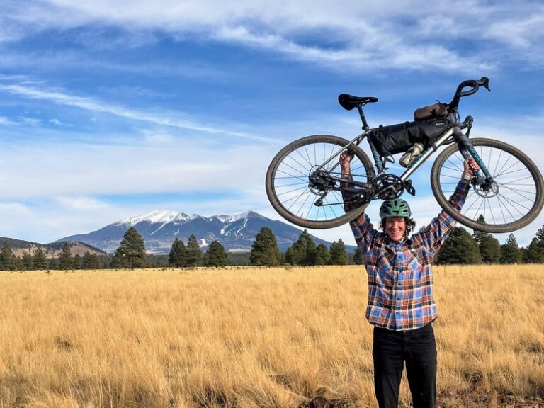
Bikepacking is something that I’d really like to do more consistently. I didn’t go at all during 2024, so I’m really grateful that I could get a trip in so early during 2025. And spending 3 days on the bike let me know that my plan to complete the 300-mile Pinyons and Pines event in May might be a little harder than I thought…… but that just means I’ll feel even more accomplished than anticipated when I finish.
Since this trip in February, I’ve returned to Atlanta, GA as my home base for March and April. I’m spending my time here learning to dance west coast swing, training for Pinyons and Pines, and enjoying quality time with family.
In a couple weeks I will head to Honduras for a week of scuba diving and then connect with another friend in Guatemala for a week of trekking and exploring.
To everyone that’s read this far – I really appreciate you! And to anyone who hasn’t – I appreciate you too! Too bad they’ll never know because they skipped this paragraph. Oh well. Until next time – wishing everyone peace, love, and happy adventuring!
Great content! Keep up the good work!